
Climate change is reshaping the risk landscape for cities across the United States. Rising seas, stronger storms, extreme heat, prolonged droughts, rampant wildfires, and intense flooding are increasingly testing the resilience of urban areas.
While no place is entirely immune to climate impacts, some cities are far better positioned to withstand these challenges than others according to cssh.northeastern.edu.
In evaluating city resilience, we looked at exposure to sea-level rise and coastal storms (hurricanes/typhoons), frequency of heatwaves and urban heat island severity, propensity for droughts and water scarcity, vulnerability to wildfires (especially for
Western cities near fire-prone forests or grasslands), incidence of inland flooding (from heavy rainfall or river overflow), and exposure to severe storms (including tornadoes, derechos, and winter storms).
We also considered each city’s natural buffers (e.g., elevation, wetlands, tree canopy), infrastructure robustness, and any ongoing climate adaptation initiatives (like flood defenses or heat action plans).
Top 10 Most Climate-Resilient U.S. Cities
The following cities have emerged relatively safe havens in a warming world. They tend to be inland or higher-elevation locales with ample fresh water and fewer extreme-weather events historically.
Many enjoy moderate climates (avoiding both severe heat and intense cold), and they often have strong infrastructure or proactive climate action plans.
Rank
City (State)
Key Climate Resilience Factors
1
Pittsburgh, PA
Inland, elevated terrain; low disaster losses; abundant water; robust climate action.
2
San Francisco, CA
Mild coastal climate; high preparedness (first city with resilience plan); strong infrastructure (but adapting to rising seas).
3
Seattle, WA
Cool, wet climate; low wildfire risk in city; lowest natural disaster losses; extensive green infrastructure.
4
Cleveland, OH
Great Lakes water buffer; no hurricanes; high community resilience; sustainability initiatives.
5
Boston, MA
Northern coastal location; aggressive flood mitigation (barriers, elevating infrastructure); high resilience capacity.
6
Washington, D.C.
Inland (minimal hurricane impact); lower heat risk than South; strong public transit and LEED-certified buildings.
7
Portland, OR
Temperate Pacific NW climate; ample rainfall and green space; low climate disaster losses; early climate action leadership.
8
Syracuse, NY
Cool inland climate; insulated from coastal storms; investing heavily in climate resilience infrastructure.
9
Harrisburg, PA
Inland with moderate climate; some flood risk but very high community resilience and low overall disaster losses.
10
Buffalo, NY
Great Lakes moderating climate; plentiful fresh water; low wildfire/hurricane risk; proactive adaptation planning.
1. Pittsburgh, Pennsylvania
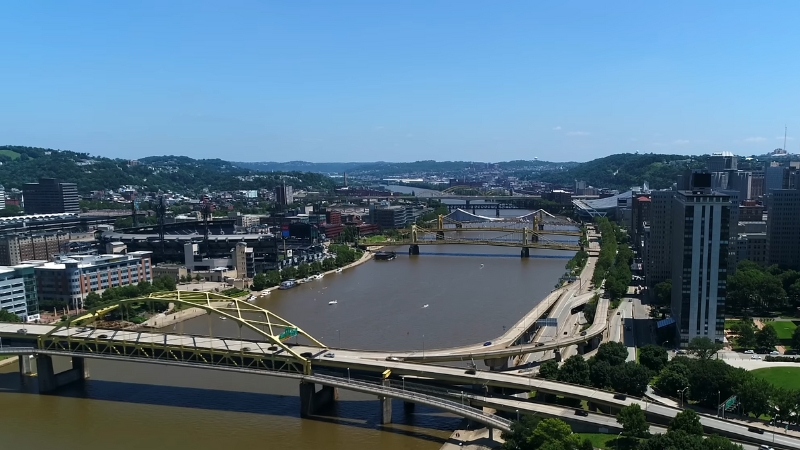
“Climate refuge” in the Rust Belt. Pittsburgh’s inland geography and higher elevation shield it from coastal threats like hurricanes and sea-level rise. As a result, it experiences very low expected losses from natural disasters – FEMA models estimate only about $23 in annual climate-related loss per resident, far below most cities, according to insurify.com.
Home insurance costs in Pittsburgh are accordingly 61% cheaper than the U.S. average, reflecting its safer locatio. This former steel town does face some climate challenges (flash flooding along its rivers, landslides on its hills, and the occasional heat wave or cold snap).
However, Pittsburgh is tackling these issues head-on with ambitious planning. The city’s Climate Action Plan aims for 100% renewable energy in city facilities by 2030 and aggressive emissions cuts.
As part of the Rockefeller Foundation’s 100 Resilient Cities initiative, Pittsburgh also developed a comprehensive resilience strategy to modernize infrastructure (energy grids, water systems), expand green infrastructure, and preserve affordable housing.
Thanks to its ample fresh water (three rivers), extensive park system, and proactive governance, Pittsburgh tops the list as a city likely to withstand and adapt to climate pressures.
2. San Francisco, California
High planning capacity amid rising seas. San Francisco might seem an unlikely climate haven at first glance – it’s a coastal city built on a bay, facing threats from sea-level rise and earthquakes.
Indeed, NOAA projects about 2.1 meters (7 feet) of sea-level rise by 2100 for the Bay Area under high-emission scenarios, which could inundate areas like SF’s airport and low-lying neighborhoods.
However, San Francisco scores extremely well on resilience measures. It has a FEMA community resilience score of 86.7 (out of 100, indicating robust capacity to prepare for and recover from disasters.
The city was the first in the U.S. to complete a 100 Resilient Cities plan, emphasizing earthquake-safe infrastructure, seawalls and flood defenses, and “hazard-resistant” housing development.
Thanks to strict building codes and decades of investing in infrastructure, SF’s expected annual climate loss per capita is only $20 (a figure that does include earthquake risk).
San Francisco does grapple with challenges like a regional wildfire-season smoke (from fires in other parts of California) and a statewide insurance crunch (insurers withdrawing due to wildfire losses).
But overall, its mild climate (rarely too hot or cold) and strong adaptation efforts (e.g, elevating structures, restoring wetlands as buffers) make it one of the most climate-resilient major cities. San Francisco demonstrates that wealth and planning can offset many natural risks, though continued vigilance is needed as seas rise.
3. Seattle, Washington
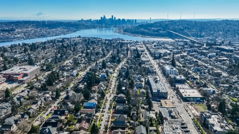
Water-rich and minimally hazard-prone. Seattle enjoys a marine climate with abundant rainfall and moderate temperatures year-round, sparing it from extreme heat or deep drought.
Critically, it has the lowest disaster damage expectancy of any large U.S. city – just $5 per capita in annual losses from natural hazards, per FEMA’s National Risk Index. This means very few costly disasters strike Seattle compared to elsewhere.
The city is far north of Hurricane range and, unlike California, Western Washington’s rainforests mitigate wildfire spread (Seattle itself is rarely threatened by wildfires, though smoke can blow in from distant fires).
Seattle’s biggest natural risk is seismic (earthquakes), not climate-related – and the city has invested billions in strengthening roads, seawalls, and the electric grid to withstand quakes.
On climate, Seattle has been proactive: it developed a detailed Disaster Recovery Framework and was an early adopter of green infrastructure (like green roofs and urban forests) to absorb heavy rains. With a 74.8 resilience score and extensive public transit usage (7% of residents commute via transit, limiting emissions).
Seattle is well-positioned to maintain livability. That said, the Pacific Northwest isn’t immune to change – models project wetter winters and stronger storms for the region as the climate warms, which could elevate flood risks over time. Seattle’s strategy of restoring coastal habitats and upgrading stormwater systems will be key to stay ahead of these changes.
4. Cleveland, Ohio
View this post on Instagram
Great Lakes buffer and strong community resilience. Cleveland benefits enormously from its geography. Sitting on Lake Erie, it has access to plentiful fresh water and is shielded from hurricanes and coastal storm surges. It does see occasional heavy snow or rain, but overall,l fewer climate extremes than many other parts of the country.
Perhaps surprisingly, Cleveland ties for one of the highest resilience scores among large metros – 96 out of 100 on FEMA’s scale. This reflects factors like preparedness, social cohesion, and emergency response capacity.
While Cleveland will need to manage increasing Great Lakes flooding and erosion (the region has seen more frequent heavy rain), the city is actively preparing.
After the U.S. briefly withdrew from the Paris Agreement, Cleveland joined over 400 cities in a bipartisan climate coalition and launched Sustainable Cleveland, an initiative that has added bike lanes, urban solar programs, and tree planting to boost climate resilience.
Economically, Cleveland’s affordability (median home price ~$216k) also means more resources can go into resilience upgrades rather than sky-high costs. In short, Cleveland’s lack of inherent climate risks (no wildfires, no sea-level issue, moderate heat) combined with its robust planning makes it a secure bet to handle the coming decades.
The main things to watch will be managing heavy precipitation events and ensuring its aging infrastructure can handle more intense storms.
5. Boston, Massachusetts
Combining coastal adaptation with high resilience. Boston is one of the few coastal cities to make the “most resilient” list, thanks to aggressive adaptation efforts and its northern location. Boston does face significant flood risk – it’s surrounded by water on three sides (Boston Harbor and the Charles River).
Its waterfront and riverfront areas are vulnerable to storm surges (as seen during Nor’easters and events like 2012’s Sandy, which impacted Boston). However, the city has taken extensive measures to mitigate these risks.
Boston’s strategy includes constructing elevated berms, seawalls, and even “living shoreline” projects as natural buffers. The city tracks over 80 coastal resilience projects (e.g, park retrofits, raised roads) aimed at preventing flood damage.
With a high FEMA resilience score of 93.4 and lower-than-average insurance losses, Boston can “ride out” climate change better than most peers. For example, its expected annual loss per capita is around $79 – not trivial, but manageable relative to high-risk cities.
Boston’s climate plans also benefit from a strong transit network (nearly 10% use public transit to commute) and dense, walkable neighborhoods, which reduce car emissions and urban heat. Looking ahead, Boston will need to keep an eye on sea-level rise acceleration.
Current projections are on the order of 2 to 4 feet by late century for Boston Harbor, meaning today’s defenses must continue to be strengthened. Nonetheless, among major coastal metros, Boston stands out for treating climate threats seriously and leveraging its considerable resources to adapt.
6. Washington, D.C.
@communitywatercenter We’re in D.C. for #WaterWeek2024 with the Water Equity & Climate Resilience Caucus telling Congress #WaterIsAHumanRight ♬ original sound – Community Water Center
Mild climate and sustainable infrastructure. The nation’s capital benefits from being inland (about 100 miles from the open ocean) at a relatively high elevation.
While Washington can get hot, it doesn’t routinely see the extreme triple-digit heat of the Deep South, and it’s too far north for the worst hurricanes (though remnants of hurricanes can cause heavy rain). Washington’s home insurance costs are relatively low (about $1,200/year on average), and its expected disaster losses are modest at $70 per capita.
One factor setting D.C. apart is its emphasis on sustainable infrastructure: D.C. boasts the highest LEED-certified building area per capita in the country – 86 square feet of green building space per person.
Strict building standards for energy efficiency and stormwater management mean new development is more climate-resilient by design. Additionally, 41% of Washington area residents commute via public transit or work from hoe, second-highest in the U.S., which reduces congestion and pollution (and can help in heat – fewer cars means lower urban heat emissions).
Of course, D.C. is not without risks: the Potomac River and Chesapeake Bay pose flood hazards, and the city has seen more frequent flash-flooding in recent years as heavy downpours increase.
But extensive levee systems on the Potomac and the city’s flood emergency plans have thus far contained major events. With its robust economy and federal support, Washington has the means to continue fortifying itself. Overall, D.C.’s temperate Mid-Atlantic climate plus forward-looking city planning earn it a spot among the top climate-resilient cities.
7. Portland, Oregon
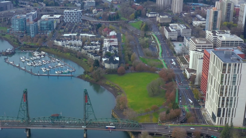
Green pioneer with low climate losses. Portland’s Pacific Northwest setting confers natural advantages: it has a temperate, wet climate that keeps the city lush and largely safe from drought. It is far from hurricane zones and generally escapes extreme heat (though it has had occasional heat waves, the baseline is much cooler than the Southwest).
FEMA ranks Portland’s expected annual climate losses at just $10 per person – thanks to few disasters historically, and the city’s resilience score is a solid 71.7. Portland was a climate action trailblazer, becoming the first U.S. city to adopt a carbon emissions reduction plan back in 1993.
This early start means Portland has had decades to integrate sustainability into urban planning, from its 400+ miles of bike lanes (making biking a viable commute for many) to strong land-use policies that limit sprawl.
Approximately 36% of Portland’s metro residents either use alternative transit or telecommute, reducing strain on infrastructure and improving air quality, according to Oregon metro. One looming concern for Portland is the projection of fewer but stronger winter storms in the Pacific Northwest with climate change.
This could test Portland’s flood management – the region expects more intense rainfall when storms do occur, potentially swelling rivers. Portland’s response has been to double down on nature-based solutions: protecting wetlands, headwaters, and floodplains around the city to absorb floodwaters.
This eco-centric approach, combined with Portland’s relatively sheltered location, makes it highly resilient. The city will likely remain a haven from the more life-threatening climate impacts (like sea inundation or megafires) seen elsewhere.
8. Syracuse, New York
View this post on Instagram
Emerging “climate haven” in Upstate New York. Syracuse is increasingly cited as a potential climate refuge city in the coming decades.
It has a humid continental climate – cold winters and warm summers – but as the planet heats up, Syracuse’s winters are becoming milder and its summers still far more tolerable than the South or Southwest.
Crucially, Syracuse is well-insulated from coastal threats: it’s about 200+ miles from the Atlantic and at ~400 feet elevation, so sea-level rise is irrelevant here. It doesn’t face hurricanes, and while it gets heavy snow, that risk may diminish (or shift to heavy rain) with climate change.
The city is preparing to leverage its advantages: Syracuse is investing a remarkable $1.8 billion annually in climate resilience infrastructure, about 9.7% of its capital budget.
Projects include an $8 million flood storage initiative on Onondaga Creek to prevent urban flooding. Syracuse also recognizes that as temperatures creep up, the city can stay comfortable by boosting its urban tree canopy – an active plan aims to raise tree cover from 27% to 34%, adding 57,000+ new trees over 20 years to provide cooling shade and absorb runoff.
With a high resilience score (88.3) and very affordable insurance (rates ~58% below national average), Syracuse is well-positioned to “survive and thrive” under climate change.
It has ample fresh water (nearby Finger Lakes and Lake Ontario), and its biggest hurdle may be attracting people and jobs – something that could change as Americans begin to gravitate toward safer climates.
9. Harrisburg, Pennsylvania
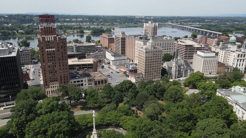
Small capital city with big resilience. Harrisburg, the capital of Pennsylvania, might fly under the radar, but it boasts some impressive climate resilience metrics.
FEMA’s data give Harrisburg a 94.8/100 resilience score – reflecting strong emergency management and social stability – and its average home insurance premium is the lowest on this top ten list (about $1,064, which is 63% below the U.S. average).
This indicates insurers see relatively low risk in the area. Harrisburg’s inland location spares it from coastal calamities, and it doesn’t suffer the extremes of heat seen further south. The one significant climate threat to Harrisburg is river flooding.
The city is bisected by the Susquehanna River, and almost half of Harrisburg’s properties have over a 26% chance of flood damage over the next 30 years. This is a legacy of building in a river floodplain, and climate change could amplify heavy rain events.
Notably, a massive flood control plan (a flood wall) was proposed after Hurricane Agnes in 1972 but never fully realized.
Even so, Harrisburg has coped well with recent floods, and the U.S. Army Corps’ Silver Jackets program has produced detailed inundation maps to aid local planning.
The city’s very high resilience score suggests that, despite the flood risk, Harrisburg’s population and infrastructure are relatively prepared and quick to recover from adverse events.
With continued investment in flood mitigation (e.g., levees, wetland restoration) and its advantageous climate, Harrisburg is expected to remain a comparatively safe place to live as our climate changes.
10. Buffalo, New York
Cool, water-abundant, and adapting for the future. Buffalo has been touted as a climate haven in several analyses, and it secures the #10 spot on our list.
Located on the shores of Lake Erie in upstate New York, Buffalo has long, snowy winters and mild summers – a climate profile that is shifting to shorter winters and slightly hotter summers, but overall will remain far more temperate than most U.S. cities.
Its proximity to the Great Lakes keeps Buffalo cooler in heat waves (large water bodies moderate extreme temperatures).
Importantly, Buffalo faces no hurricane risk, negligible sea-level rise issues (being 600+ feet above sea level), and minimal wildfire risk. FEMA data show very low annual expected losses (~$21 per capita) and a high resilience score (~93.6) for Buffalo.
The city has taken notice of its fortunate position and is actively planning for climate migration and adaptation. Buffalo received $220,000 from New York’s Climate Smart Communities program to assess its vulnerabilities and craft climate action and adaptation plans.
One area of concern is the potential for more intense precipitation and heavy lake-effect snow as the Great Lakes warm. Buffalo has seen record-breaking snowstorms, such as the November 2022 blizzard.
As the climate warms, those could translate into heavy rain events that test drainage systems. Nonetheless, Buffalo’s challenges are manageable compared to sea-flooded or drought-stricken cities elsewhere.
With abundant fresh water, affordable housing, and proactive leadership, Buffalo is likely to not just survive but potentially prosper in a changing climate, attracting residents from less fortunate regions.
Overall, the most resilient cities share a few notable traits: they are often northern and inland, away from the frontlines of sea-level rise and tropical cyclones. Many are midsized cities with strong civic planning cultures.
Access to ample freshwater (e.g., Great Lakes or robust aquifers) is a common theme, as is an absence of extreme heat – none of these top 10 cities currently endures the kind of 100°F+ summers that plague parts of the South and Southwest.
Of course, these cities are not risk-free – several must deal with flooding from rivers or heavier rain, and all will feel some effects of rising temperatures. But relative to other places, they have the geography and the governance to fare much better shortly of climate change.
Top 10 Least Climate-Resilient U.S. Cities
Which cities are most at risk from climate change? Unfortunately, many of the urban areas “least likely to survive” unscathed are in harm’s way due to their low-lying geography or extreme climates, often compounded by large populations and vulnerable infrastructure.
Coastal cities, especially in the Southeast, dominate this list, reflecting the potent combination of sea-level rise, storm surge, and high heat/humidity.
Several Florida and Gulf Coast cities already experience regular flooding and face escalating hurricane threats, putting them on the frontline.
Rank
City (State)
Key Climate Vulnerabilities
1
Miami, FL
Sea-level rise (rising seas + subsidence), frequent flooding, high-impact hurricanes, extreme heat/humidity.
2
New Orleans, LA
Below sea level (sinking land), storm surge exposure, weakening wetlands, and high hurricane frequency.
3
Cape Coral, FL
Low-lying coastal city, hit by major hurricanes (Ian), water stress issues, and extreme heat risk.
4
Houston, TX
Gulf Coast city prone to hurricanes (Harvey), severe flooding (64% properties at risk), and urban extreme heat.
5
Charleston, SC
Sea-level rise flooding (nuisance floods common), coastal storm/hurricane risk, hot summers.
6
Baton Rouge, LA
Gulf hurricane risk, intense rainfall flooding, high wind damage risk, and aging infrastructure.
7
Tampa, FL
Very exposed to hurricane storm surge (Tampa Bay), sea-level rise, increasing extreme heat, and heavy rain.
8
North Port, FL
Coastal SW Florida location, high hurricane wind risk, 98th percentile hazard risk overall, rapid growth in flood-prone areas.
9
Palm Bay, FL
Low elevation on Atlantic coast, flood-prone (lagoon and rainfall flooding), storm surge risk, heat stress.
10
McAllen, TX
Inland (Rio Grande Valley) but extreme heat (desert climate), periodic hurricane winds/flooding, limited water resources.
1. Miami, Florida
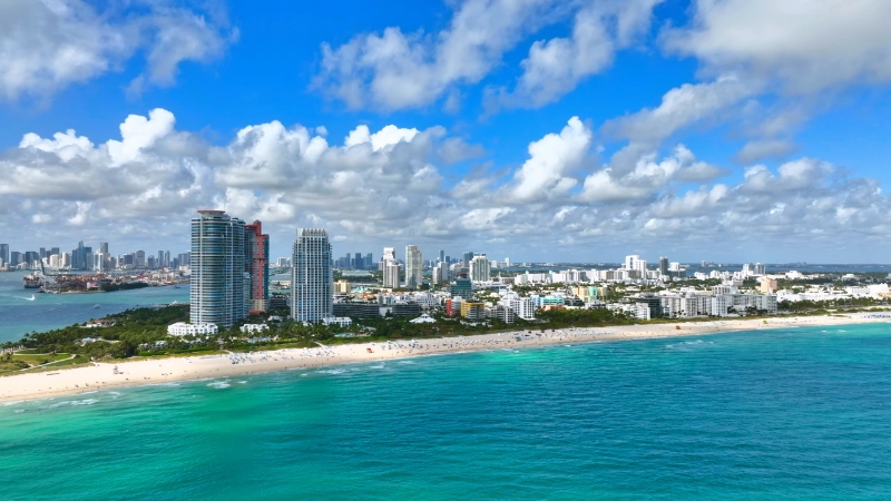
Ground Zero for sea-level rise. Miami sits barely above sea level on porous limestone, and it’s experiencing regular “sunny day” tidal flooding even on clear days.
The latest projections are dire: a 2-meter rise in sea level (about 6.6 feet) would put roughly 1 million Miami-Dade County residents and $129 billion in property at risk.
NOAA expects on the order of 2.1 m of sea rise by 2100 in this region under high scenarios, meaning Miami faces an inundation threat by late century.
Even in the nearer term, by 2050 seas could be ~ one foot higher or more in South Florida, worsening storm surges. Miami also lies in the crosshairs of hurricanes – in 2017, Hurricane Irma sent shockwaves up Biscayne Bay and flooded downtown streets.
On top of water issues, Miami endures extreme heat (it feels like 100°F+ with humidity many summer days) and is trending hotter. Little wonder Miami now has the second-highest average home insurance cost in the nation (nearly $17,000/year) as insurers retreat from the market.
The city is fighting back with the Miami Forever Climate Ready strategy, which includes building more green stormwater infrastructure and community resilience hubs to deal with floods and heat. These efforts might buy Miami time, but the combination of rising seas, stronger hurricanes, and groundwater intrusion makes it arguably the most climate-endangered city in the U.S..
2. New Orleans, Louisiana
Sinking land in a rising ocean. New Orleans is a poignant case of a city already devastated by climate extremes (Hurricane Katrina in 2005) and facing even greater challenges ahead.
The city is built on subsiding delta soil; on average, Orleans sits about 6 feet below sea level today, protected only by levees and pumps.
Coastal Louisiana has seen a “burst of rapid sea level rise” in the past decade – about 7 inches of rise since 2009 near New Orleans, a rate scientists didn’t expect until late in the century, according to washingtonpost.com.
This rapid change is eroding the coastal wetlands that buffer storm surges. Areas of New Orleans and the Gulf Coast are now sinking as fast or faster than global sea levels are rising, exacerbating flood risk.
Practically, this means the protective levee system is under unprecedented strain: even a moderate hurricane can push water against levees that have less freeboard (clearance) than before. Indeed, higher rates of subsidence correlate with higher future flood risk for New Orleans, as noted by abcnews.go.com.
The city is also a bullseye for major hurricanes – since Katrina, storms like Isaac (2012) and Ida (2021) have tested the improved flood defenses. In Hurricane Ida’s aftermath, large portions of New Orleans were left without power for weeks, highlighting infrastructure vulnerability.
Climate change is projected to bring more intense rain as well, potentially overwhelming the pumping system during storms. New Orleans’ city government is not standing idle – they are rebuilding and elevating structures to 500-year flood standards and implementing integrated water management strategies, as noted by climatecheck.com.
But with land sinking, seas rising, and storms strengthening, New Orleans faces a very rough road. Without massive and continual investments in flood protection (and even relocation of some communities), the city’s long-term survival is in peril.
It’s no exaggeration to say New Orleans is one major storm away from disaster at any given time, making it one of the least climate-resilient locales in America.
3. Cape Coral, Florida
View this post on Instagram
High growth in a high-risk location. Cape Coral is a boomtown of over 200,000 in Southwest Florida, known for its canals and waterfront homes and unfortunately, it lies directly in hurricane alley.
In 2022, Hurricane Ian made landfall just to its south, pushing a massive surge into Cape Coral and neighboring Fort Myers. Ian destroyed an estimated 5,000 homes in the area and caused $40–64 billion in insured losses statewide.
Cape Coral exemplifies the compound threats of sea-level rise + extreme storms + heat. It has one of the nation’s highest “chronic physical climate risks”, according to Moody’s Analytics, meaning the long-term changes (rising heat, rising seas, water scarcity) are expected to be very severe here.
Moody’s specifically flags heat and water stress alongside sea-level rise as big issues – South Florida is projected to get significantly hotter and could face freshwater shortages as saltwater infiltrates aquifers.
Cape Coral also has very low inherent resilience: FEMA gives it a community resilience score of just 9.2/100, indicating limited capacity to bounce back after disasters (perhaps due to rapid growth and many new residents). The insurance market is reacting accordingly – the average home insurance premium in Cape Coral is over $10,000, more than triple the U.S. average.
In short, Cape Coral is a hot, flat, coastal city that faces more intense hurricanes and steadily rising seas in the coming decades. Without significant adaptation (strengthening building codes, elevating homes, improving water supply systems), Cape Coral’s future is daunting. It serves as a warning about unchecked development in climate-exposed areas.
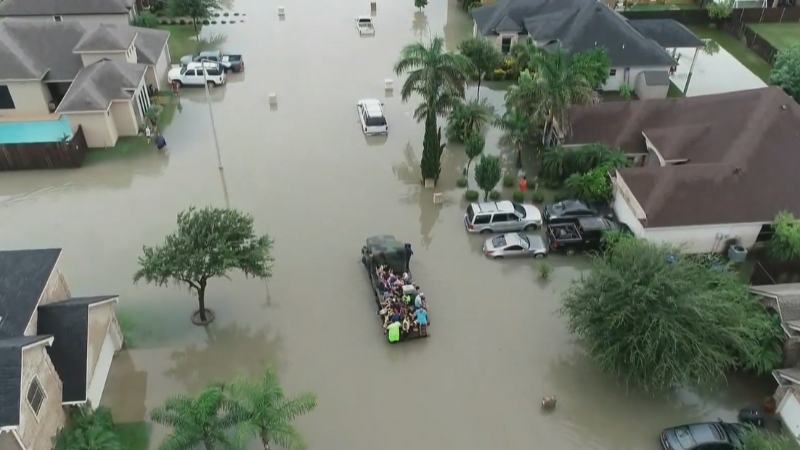
4. Houston, Texas
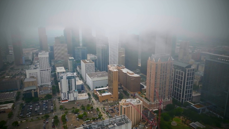
Big city, big climate risks. Houston is America’s fourth-largest city and an economic powerhouse, but its geography makes it acutely vulnerable to climate disasters. Sitting on the Gulf Coastal Plain, much of Houston is flat, low-lying, and interlaced with bayous that frequently overflow.
The city is notorious for flooding: even heavy thunderstorms can inundate neighborhoods. Hurricanes pose a regular threat – Houston has a ~25% chance of a hurricane impact each year, and in 2017, Hurricane Harvey stalled over the area and dumped up to 50 inches of rain, a U.S. record. Harvey’s flooding affected nearly 214,000 properties in Houston alone.
According to the First Street Foundation’s Risk Factor analysis, a staggering 64% of properties in Houston have at least a 26% chance of major flooding over the next 30 years.
This essentially means two-thirds of Houston structures could experience severe flood damage by 2050, absent mitigation. In addition, Houston’s subtropical climate is getting hotter – extreme heat days and warm nights are on the rise, straining the power grid during summer.
The city also struggles with industrial pollution (it’s a petrochemical hub), compounding environmental stresses like poor air quality on hot days.
FEMA scores Houston’s community resilience as low (27.9) and expected annual losses per capita high (~$507). Indeed, insurance costs are soaring here too, averaging $5,500/year (double the U.S. norm).
On the positive side, Houston has launched a Resilient Houston plan to adapt – one innovative goal is to restore native prairie and wetland plants along bayous to enhance drainage and even remove all homes from the highest-risk floodway by 2030.
Such moves are crucial. But given Houston’s sheer size and sprawl, climate change will test it repeatedly with catastrophic floods and heatwaves. Without major interventions, Houston’s ability to remain habitable will be severely challenged, making it one of the least climate-resilient big cities in the U.S.
5. Charleston, South Carolina
TROPICS: Tropical Storm Debby this morning is about 65 miles south/southeast of Charleston, and is drifting to the east at only 5 mph. Thankfully some drier air entered the circulation yesterday and has really reduced the rain coverage and intensity along the coast of the… pic.twitter.com/Q4gOK8q3DN
— James Spann (@spann) August 7, 2024
Historic city facing a watery future. Charleston is a charming coastal city with centuries of history – and it’s on the front lines of sea-level rise and coastal flooding on the U.S. East Coast. Parts of the city flood regularly during high tides and rainstorms; locals call it “nuisance flooding” as roads become canals on sunny days.
Charleston is projected to see roughly 14 inches of sea-level rise by 2050 (compared to 2000 levels) according to NOAA. This rise, combined with more intense rainfall, means flooding will become more frequent and severe.
In terms of acute risks, Charleston lies in the path of hurricanes and tropical storms that move up the Southeast coast. A direct hit could bring a devastating surge into Charleston Harbor.
A recent analysis by Moody’s Analytics found the Carolinas coast (around Charleston and up to NC) has the nation’s highest acute hazard risk due to climate change, largely owing to storm surge and wind damage potential.
The expected annual losses per person in Charleston are around $791 – among the highest in the country – and home insurance premiums average over $5,100. Despite these risks, Charleston does have some strengths: its FEMA resilience score is relatively high (79), likely reflecting good governance and disaster response capacity.
The city has a Flooding & Sea Level Rise Strategy that includes new drainage projects, pumps, and even exploring surge barriers. Charleston is trying to adapt by elevating roads and preserving open space for water storage.
However, with many historic buildings at low elevation and limited options to relocate infrastructure, Charleston’s long-term viability is threatened. By mid-century, what is now a nuisance could become an almost constant inundation in low areas.
For residents and policymakers, the writing is on the wall: without aggressive adaptation (and even that might not be enough), Charleston’s battle with the rising sea will only get harder.
6. Baton Rouge, Louisiana
View this post on Instagram
In the hurricane belt with limited buffers. Baton Rouge, the capital of Louisiana, sits about 80 miles inland from the Gulf – far enough to avoid direct coastal storm surge, but still very much exposed to hurricane winds and heavy rainfall.
Baton Rouge was walloped by Hurricane Gustav in 2008 and was sideswiped by Hurricane Ida in 2021 (which thankfully shifted last-minute, sparing the city a direct hit). The region’s flat topography and network of rivers (like the Mississippi) make it prone to flooding from extreme rain events
Baton Rouge’s expected annual per-capita loss from natural hazards is a whopping $787, per FEMA dat–, reflecting the high probability of costly storms.
A Realtor.com analysis found that extreme winds could put $67.4 billion worth of homes in the Baton Rouge metro at risk (this includes hurricane winds and tornadoes spawned by tropical systems).
Louisiana as a whole is seeing an insurance availability crisis; rates are jumping by 20-30%, and some insurers have left due to repeated disasters. Baton Rouge’s average insurance cost (~$4,125) is lower than coastal Louisiana but still ~30% above the U.S. average.
On top of storms, Baton Rouge faces intense summer heat (90°F+ highs for long stretches with stifling humidity), which climate change is intensifying. The city is working on bolstering its resilience – a stormwater master plan is adding green space that doubles as drainage and tightening development codes to require better floodwater detention. These steps will help incrementally.
Nonetheless, Baton Rouge remains highly vulnerable due to its geography in the hurricane-prone Gulf Coast and the reality that a very powerful storm could still drive damaging winds and rains this far inland.
It underscores that you don’t have to be on the coast to be among the least resilient – just being in a frequent disaster zone with inadequate natural barriers lands Baton Rouge on this unenviable list.
7. Tampa, Florida
The hurricane nightmare scenario. The Tampa Bay area has long been cited by experts as one of the U.S. metro areas most at risk for a catastrophic hurricane.
The region juts into the Gulf of Mexico and has shallow bay waters that could amplify storm surge. Remarkably, Tampa has not had a direct hit by a major hurricane in a century – a lucky streak that many fear could end at any time.
If a Category 4 or 5 storm barreled into Tampa Bay, the storm surge could inundate downtown Tampa and St. Petersburg with 20+ feet of water in worst-case scenarios.
Even today, extreme wind threatens about $464 billion in residential property in the Tampa Bay area, according to Realtor.com, ranking among the highest exposures in the country. Climate change is increasing the odds: warmer Gulf waters mean bigger storms, and sea-level rise is making storm surges higher.
ClimateCheck warns that Tampa’s storms and surges will grow more destructive as oceans warm. Tampa is also dealing with a growing heat problem – Florida’s interior is seeing more days above 95°F, and Tampa’s urban sprawl contributes to a heat island effect. All these factors contribute to a low resilience score (25.3) and high expected losses (>$380 per capita) for Tampa.
Unsurprisingly, insurance in Tampa costs over double the national average. Local authorities have finally begun to take action: Tampa’s Climate Action & Equity Plan calls for steering affordable housing to less flood-prone zones and helping fortify existing homes against flooding and storms.
Such measures are crucial, but the region remains extremely exposed. A direct strike on Tampa could be economically devastating and life-threatening, making it one of the least climate-resilient big cities. As one expert quipped about Tampa’s hurricane risk: “It’s not if, but when.” That looming disaster potential cements Tampa’s spot on this list.
8. North Port, Florida
New development in a high-risk zone. North Port is a fast-growing city in Southwest Florida (Sarasota County) that few outside the region may know, but it exemplifies the peril facing many smaller cities along Florida’s coast. Sarasota County ranks in the 98th percentile for overall natural hazard risk nationally, per FEMA’s index.
North Port itself has a very low resilience score (16) and high expected losses per capita ($571), meaning its population and infrastructure have trouble coping with disasters. The city was hit hard by Hurricane Ian’s winds (though the storm impacted areas just to the west).
RiskFactor data indicates North Port has a 57% chance of seeing a 5+ foot flood by 2050 due to sea-level rise and storms – essentially a coin flip chance of a major flood within our lifetimes. Adding to the concern, nearly half of North Port’s population is retirees or elderly, a vulnerable group during extreme events.
The area also faces severe wind hazards (hurricanes, tornadoes spawned by storms) that can damage the many new housing developments cropping up. Recognizing the challenge, North Port created a Natural Resources division in 2023 and has been updating land development codes to include new environmental standards.
However, as of now, those updates have not been fully adopted. In essence, North Port represents all those suburban communities along Florida’s coasts that expanded in recent decades without fully accounting for climate risks.
The convergence of rapid growth and high climate risk lands North Port on the least-resilient list. It serves as a caution: without enforced building standards and smart planning, such communities may struggle to survive repeated climate shocks.
9. Palm Bay, Florida
@yourdailynaturefix This is just some of the aftermath from yesterdays EF1 tornado that touched down in Palm Beach Gardens, FL 🌪️ Normally tornados in Florida don’t do this much damage, but this past week has been unusually active with dangerous storms. We’ve had hail twice this week in Palm Beach Gardens. #tornado #tornadoaftermath #twister #natgeo ♬ Rus Attack Discovered – Trevor Morris
Flooded by storms and facing the rising Atlantic. Palm Bay is a mid-sized city on Florida’s Atlantic coast (Brevard County), part of the Space Coast region. It has a history of flooding issues – a regional survey found nearly 48% of Palm Bay residents had experienced flooding in the past 5 years, and almost as many had wind or hail damage in that period.
This speaks to how routine storm impacts have become. Palm Bay sits on the Indian River Lagoon and low-lying land that easily floods when heavy rains coincide with high tides.
As sea levels rise, these disruptions will worsen: even relatively minor tropical storms could push water into neighborhoods and make roads impassable. Palm Bay’s average home insurance premium is around $9,900, reflecting the high risk (over triple the national average cost).
FEMA’s data show expected losses per capita around $675 – very high – which, combined with a mediocre resilience score (59.8), places Palm Bay firmly among the most vulnerable.
Another concern is that El Niño/La Niña cycles can swing hurricane activity; as one report noted, the end of a La Niña pattern could lead to a more severe hurricane season in 2024, putting Palm Bay at risk of a costly hit.
In addition to flooding, Palm Bay endures Florida’s intense heat and has large swaths of older housing that may not meet today’s hurricane codes.
The city and county are working on mitigation – for example, elevating critical infrastructure and improving drainage canals. But it’s an uphill battle. Palm Bay encapsulates the plight of many smaller coastal cities: limited resources, but facing big climate threats.
It doesn’t make national headlines, but its residents are on the front line of rising seas and storms, making it one of the least climate-resilient places almost by default of location.
10. McAllen, Texas
Scorching heat and storm shocks in the Rio Grande Valley. McAllen is a large city in Texas’s Rio Grande Valley, near the Mexican border. It’s about 80 miles from the Gulf Coast, so one might assume it’s safer from climate threats; however, McAllen faces a triple-whammy: extreme heat, periodic hurricane impacts, and water scarcity.
The city’s climate is semi-arid to subtropical, with summer highs regularly above 100°F. By mid-century, the region is projected to see many more days of extreme heat.
(For instance, Phoenix, AZ – a similar desert city – is expected to have ~44 days above 109°F each year by 2050, up from just 7 days historically, according to Reuters.com; while McAllen’s exact projection will differ, it underscores the kind of heat increase such areas face.) Heatwaves strain McAllen’s power grid and pose health dangers.
In 2023, Texas saw record heat-related ER visits, and McAllen was often among the hottest metros.
On the disaster side, hurricanes can still reach McAllen as wind events or inland flooding events. In 1967, Hurricane Beulah caused major flooding in the Valley.
According to RiskFactor, McAllen has a “moderate” flood risk but a severe wind risk (hurricanes can still be strong enough to damage roofs and power lines even this far inland. It also has an “extreme” risk of heat (no surprise).
FEMA’s community resilience score for McAllen is a shockingly low 1.1 out of 100, indicating high socioeconomic vulnerability – poverty rates are relatively high, and resources for recovery are limited. This means when disaster does strike, the community has a harder time bouncing back.
Already, the area struggles with water – the Rio Grande’s flow is dwindling due to upstream drought and usage, raising concerns about future water supply for cities like McAllen.
All told, McAllen’s high climate risks and low capacity to adapt make it one of the least resilient cities. Efforts are underway to improve the outlook: the McAllen metro released a Priority Climate Action Plan focusing on emissions cuts and resilience, and there are plans to invest in more green infrastructure and public transit.
These will help incrementally. But the reality is that McAllen, like many cities in the arid Southwest, will face an increasingly unforgiving climate (hotter and drier) while also getting occasional punches from Gulf storms – a tough combination that earns it the final spot in our bottom 10.
It’s worth noting that many other cities face serious climate challenges too. The above ten are among the most vulnerable, but others could easily be mentioned.
For example, Phoenix, AZ, does not appear on the list (since it avoids hurricanes and flooding), yet Phoenix’s future is alarming due to heat and dwindling water from the Colorado River – by 2050, Phoenix is expected to endure ~44 days per year above 109°F.
Similarly, Las Vegas, NV faces extreme heat and water shortages from the drying Lake Mead. Coastal Virginia cities like Norfolk and Virginia Beach are grappling with high tide flooding and rising seas.
And New York City – while wealthier and more resilient than most, must contend with sea-level rise threatening its 520 miles of coastline and more frequent heatwaves in its concrete jungle.
In short, climate vulnerability comes in different forms: some cities will drown, others will bake, others will burn or desiccate. Unfortunately, many of the least resilient cities identified here overlap with areas of high social vulnerability – meaning the people hit hardest often have fewer resources to adapt or move.
Trends, Differences, and Implications

Latitude and Elevation Matter
Most of the top 10 resilient cities are in the North or interior (e.g, Buffalo, Cleveland, Syracuse, Seattlee), where cooler climates and higher elevations offer protection. In contrast, the least resilient are largely in the low-lying Southeast (Florida and Gulf Coa, st) where warmth turns to oppressive heat and water is an ever-present threat.
Northern inland cities benefit from natural buffers – for instance, the Great Lakes moderate extreme temperatures and provide ample fresh water, whereas low coastal plains (Florida, Gulf Coast) amplify flooding and have shallow water tables prone to saltwater intrusion.
Sea-Level Rise and Coastal Storms
A defining vulnerability for many bottom-list cities is their exposure to the ocean’s encroachment. Miami, New Orleans, Charleston, Tampa – these places are either at sea level or sinking, and they face increasingly destructive hurricanes or nor’easters.
In Miami and New Orleans, even the ground beneath is porous or subsiding, making engineering solutions difficult.
By contrast, none of the top resilient cities face significant sea-level rise threats (even Boston and SF have robust adaptation efforts underway). This underscores that coastal resilience (or lack thereof) is a key differentiator.
Heat and Water Stress
Another big contrast is in extreme heat exposure. The resilient list features cities with moderate summers – many in northern climates or near water.
The vulnerable list includes places like McAllen, Houston, Baton Rouge (very hot, humid) and Phoenix’s challenges were noted as an outside example. Heat is called the “silent killer” because it doesn’t destroy property like floods do, but it impacts health and livability.
Additionally, water scarcity tends to accompany heat in places like the Desert Southwest (Phoenix, Las Vegas) – while our bottom 10 is dominated by flood-prone cities, drought is an equally serious climate risk that could cripple cities whose water supply (rivers, reservoirs) dwindle.
Policymakers in those regions must invest in water-efficient infrastructure, conservation, and possibly new supply solutions (like desalination) to ensure those cities can survive.
Infrastructure & Adaptation
The top resilient cities generally have invested in adaptive infrastructure or have strong urban planning.
For example, Pittsburgh and Seattle are part of networks (100 Resilient Cities) sharing best practices; Boston and San Francisco are actively constructing flood defenses; Syracuse is spending a large share of its budget on resilience projects.
These efforts boost their ability to cope. On the flip side, many least-resilient cities have insufficient or aging infrastructure.
Bottom Line
In conclusion, climate change is re-drawing the map of urban risk. The 10 cities most likely to thrive (or at least remain stable) tend to be those blessed with favorable geography and proactive planning.
The 10 cities on the bottom are those where geography works against them, and without heroic efforts, they face increasingly untenable situations. For individuals, the data and examples presented here can inform life decisions: where to live, how to insure and protect your property, and how much to invest in a community for the long haul.
For leaders, the stark differences between Buffalo and Miami, or Pittsburgh and New Orleans, should spur urgent action and smarter resource allocation.
By learning from the “climate winners,” perhaps we can help the “climate losers” have a fighting chance – but the window to act is rapidly closing. The near future will reveal which cities can innovate and adapt, and which will struggle to survive in the era of climate change.